Home › World Exploration › Dreamy Paper Plane
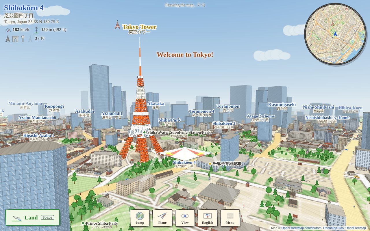
Dreamy Paper Plane
Fly a paper plane over the real world.
Land, get out, walk a little and say hello in the local language.
Jump to 33 famous cities, or anywhere on the world map.
Laptop and Chromebook
iPad and tablet
Needs the internet
Voices start off
Start
Point the mouse to steer; hold the left button to go faster. Space lands. On a tablet: drag the circle and hold GO!
For parents and teachers
- The real world, drawn in crayon or movie style: streets, buildings, rivers, parks and names come live from the OpenStreetMap map as the plane flies. Hyper-Space Jump flies around the globe to any of 33 famous cities (16 with a landmark and a short fact), or to any place picked on the world map or typed in the search box.
- Land and walk: people say hello in the language of the country, and pets answer with their own sound. Places with two languages (Canada, Belgium, Singapore and others) use both. The main language can be English, French, Spanish or Chinese, with the local name shown beside it.
- Needs the internet while flying: the map squares come from OpenFreeMap (about 2 to 4 MB per city). Place search and place names come from OpenStreetMap's Nominatim service: what a child types in the search box (towns, regions and countries only, sent when Enter or Find is pressed) and the rough spot where the plane lands are sent there to find names. Nothing goes to Daniel's Lion. The privacy page says more.
- For school networks: the activity needs tiles.openfreemap.org, nominatim.openstreetmap.org and cdnjs.cloudflare.com. If a filter blocks them, the plane flies over an empty world.
- Voices start off so a classroom stays quiet; Menu, Voices, or the speaker button on a speech bubble turns them on, using the device's own voices.
- Progress and choices (plane, paper, look, language) save on this device. Clearing the browser's site data erases them.
- Map data © OpenStreetMap contributors, OpenMapTiles, OpenFreeMap; place search by OpenStreetMap Nominatim; Earth outlines from Natural Earth.
One file, about 0.39 MB, plus one 3D library (about 0.6 MB) from a public library server, and the map while flying. No accounts, no ads, nothing collected. More for parents and teachers